
Fail:Morne-Rouge Martinique.jpg

Saiz pralihat ini: 800 × 542 piksel. Leraian-leraian lain: 320 × 217 piksel | 640 × 433 piksel | 1,024 × 693 piksel | 1,280 × 867 piksel | 1,530 × 1,036 piksel.
Fail asli (1,530 × 1,036 piksel, saiz fail: 206 KB, jenis MIME: image/jpeg)
| Lokasi kamera | | Paparkan imej ini dan imej berdekatan yang lain di: OpenStreetMap |
|---|
| Keterangan |
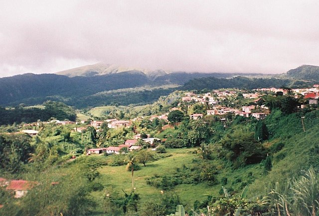
View over Le Morne-Rouge in the direction of the cloud-hidden Mount Pelée, Martinique (How can I add description in my language?) |
| Tarikh | |
| Sumber | Karya sendiri |
| Pengarang | Radosław Botev |
| Kebenaran (Penggunaan semula fail ini) |
This image is copyrighted by Radosław Botev. Permission is granted to use this picture freely for any purpose - whether commercial or not - and to make derivative works provided that the copyright holder's full name is quoted. You are also hereby permitted to redistribute this file and its derivations to a third party under any license of your choice as long as that license requires attribution to the copyright holder of this work and does not allow to ever revoke that requirement (possible examples are Creative Commons Attribution or GFDL). This shall by no means limit the right of the redistributor of this work or the right of the derivative works' creators to impose other restrictions on the use or further redistribution of this work or its derivations. English français polski +/- |
Dengan ini, saya selaku pemegang hak cipta karya ini, menerbitkannya di bawah lesen yang berikut:

|
Pemegang hak cipta fail ini membenarkan sesiapa sahaja untuk menggunakannya untuk apa-apa jua tujuan, asalkan pemegang hak cipta diberi pengiktirafan yang sewajarnya. Pengedaran semula, kerja derivatif, kegunaan komersil dan semua kegunaan lain adalah dibenarkan. |
|
|
Sejarah fail
Klik pada tarikh/waktu untuk melihat rupa fail tersebut pada waktu itu.
| Tarikh/Waktu | Gambar kenit | Ukuran | Pengguna | Komen | |
|---|---|---|---|---|---|
| semasa | 15:19, 31 Disember 2008 | | 1,530 × 1,036 (206 KB) | Botev | {{botev license|View over Le Morne-Rouge in the direction of the cloud-hidden Mount Pelée, Martinique|Widok na Le Morne-Rouge w kierunku zakrytej chmurami Montagne Pelée, Martynika|November 2008|listopad 2008}} [[Category:Cities and villages in Martini |
Penggunaan fail
Laman berikut menggunakan fail ini:
Penggunaan fail sejagat
Fail ini digunakan oleh wiki-wiki lain yang berikut:
- Penggunaan di ca.wikipedia.org
- Penggunaan di ceb.wikipedia.org
- Penggunaan di ce.wikipedia.org
- Penggunaan di el.wikipedia.org
- Penggunaan di en.wikipedia.org
- Penggunaan di en.wikivoyage.org
- Penggunaan di es.wikipedia.org
- Penggunaan di fr.wikipedia.org
- Penggunaan di fr.wiktionary.org
- Penggunaan di he.wikivoyage.org
- Penggunaan di hr.wikipedia.org
- Penggunaan di it.wikipedia.org
- Penggunaan di ja.wikivoyage.org
- Penggunaan di la.wikipedia.org
- Penggunaan di nl.wikipedia.org
- Penggunaan di oc.wikipedia.org
- Penggunaan di pl.wikipedia.org
- Penggunaan di pt.wikipedia.org
- Penggunaan di sk.wikipedia.org
- Penggunaan di sv.wikipedia.org
- Penggunaan di uk.wikipedia.org
- Penggunaan di vi.wikipedia.org
- Penggunaan di www.wikidata.org
- Penggunaan di zh.wikipedia.org