
Fail:Romanbritain.jpg
Saiz pralihat ini: 375 × 599 piksel. Leraian-leraian lain: 150 × 240 piksel | 300 × 480 piksel | 854 × 1,364 piksel.
Fail asli (854 × 1,364 piksel, saiz fail: 712 KB, jenis MIME: image/jpeg)

|
This old map image could be re-created using vector graphics as an SVG file. This has several advantages; see Commons:Media for cleanup for more information. If an SVG form of this image is available, please upload it and afterwards replace this template with
{{vector version available|new image name}}.
It is recommended to name the SVG file “Romanbritain.svg”—then the template Vector version available (or Vva) does not need the new image name parameter. |


Ringkasan
| Keterangan |
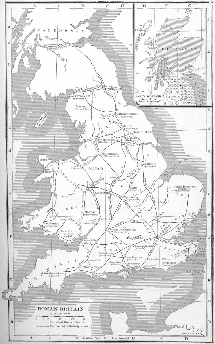
English: An outdated map of the Roman road network in Britain |
||||
| Tarikh | |||||
| Sumber | Atlas of European History, London: G. Bell & Sons, 1910 | ||||
| Pengarang | Earle W. Dowe; uploaded to English Wikipedia 22:04, 1 April 2005 by Adamsan | ||||
| Kebenaran (Penggunaan semula fail ini) |
|
||||
| Versi lain |
|
||||


Sejarah fail
Klik pada tarikh/waktu untuk melihat rupa fail tersebut pada waktu itu.
| Tarikh/Waktu | Gambar kenit | Ukuran | Pengguna | Komen | |
|---|---|---|---|---|---|
| semasa | 14:33, 11 September 2011 | | 854 × 1,364 (712 KB) | Gauravjuvekar | rotated |
| 00:37, 21 Julai 2005 |  | 880 × 1,394 (180 KB) | Nicke L | From the English Wikipedia Description: Map of Roman Britain from Atlas of European History, Earle W Dowe, London, G Bell & Sons, 1910 Uploaded 22:04, 1 April 2005 by Adamsan {{PD}} Category:Historical maps of the United Kingdom [[en:Image:Roma | |
| 00:35, 21 Julai 2005 |  | 378 × 599 (60 KB) | Nicke L | From the English Wikipedia Description: Map of Roman Britain from Atlas of European History, Earle W Dowe, London, G Bell & Sons, 1910 Uploaded 22:04, 1 April 2005 by Adamsan {{PD}} Category:Historical maps of the United Kingdom [[en:Romanbrita |
Penggunaan fail
2 buah laman berikut menggunakan fail ini:
Penggunaan fail sejagat
Fail ini digunakan oleh wiki-wiki lain yang berikut:
- Penggunaan di ast.wikipedia.org
- Penggunaan di be-tarask.wikipedia.org
- Penggunaan di br.wikipedia.org
- Penggunaan di ca.wikipedia.org
- Penggunaan di cs.wikipedia.org
- Penggunaan di de.wikipedia.org
- Penggunaan di en.wikipedia.org
- Penggunaan di es.wikipedia.org
- Penggunaan di fi.wikipedia.org
- Penggunaan di fr.wikipedia.org
- Penggunaan di fy.wikipedia.org
- Penggunaan di hu.wikipedia.org
- Penggunaan di id.wikipedia.org
- Penggunaan di is.wikipedia.org
- Penggunaan di it.wikipedia.org
- Penggunaan di ja.wikipedia.org
- Penggunaan di ja.wikibooks.org
Lihat banyak lagi penggunaan sejagat bagi fail ini.