
Fail:Deforestation in Malaysian Borneo.jpg
Saiz pralihat ini: 800 × 600 piksel. Leraian-leraian lain: 320 × 240 piksel | 640 × 480 piksel | 1,024 × 768 piksel | 1,280 × 960 piksel | 2,400 × 1,800 piksel.
Fail asli (2,400 × 1,800 piksel, saiz fail: 1.47 MB, jenis MIME: image/jpeg)
Ringkasan
| Keterangan |
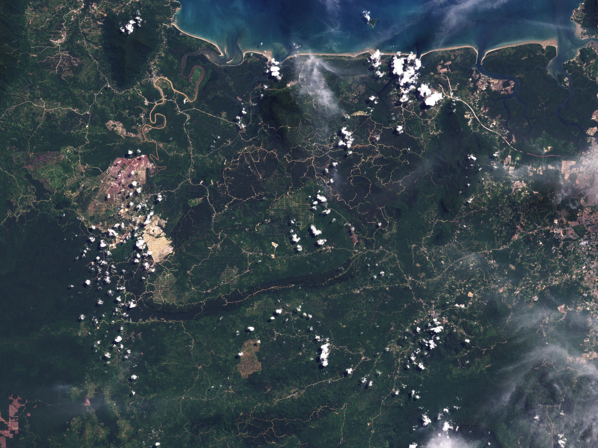
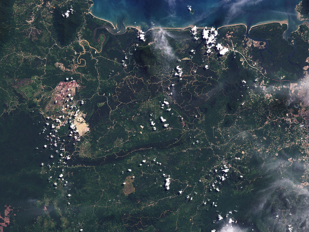
English: The image has a resolution of 30 meters per pixel. Spanning about 22,000 meters, this image shows the difference between plantation and intact forest in part of Malaysian Borneo. The greens of the plantation are paler than those of the surrounding forest, and paths or roads criss-cross the groves. The image reveals the overall extent of land-cover change throughout the region. |
| Tarikh | |
| Sumber | NASA Earth Observatory |
| Pengarang | Jesse Allen and Robert Simmon |
Instrument: Landsat 7 - ETM+
Perlesenan
| This file is in the public domain in the United States because it was solely created by NASA. NASA copyright policy states that "NASA material is not protected by copyright unless noted". (See Template:PD-USGov, NASA copyright policy page or JPL Image Use Policy.) | ||
 |
Warnings:
|
| Annotations | This image is annotated: View the annotations at Commons |
Sejarah fail
Klik pada tarikh/waktu untuk melihat rupa fail tersebut pada waktu itu.
| Tarikh/Waktu | Gambar kenit | Ukuran | Pengguna | Komen | |
|---|---|---|---|---|---|
| semasa | 09:11, 10 September 2009 | | 2,400 × 1,800 (1.47 MB) | Originalwana | {{Information |Description={{en|1=The image has a resolution of 30 meters per pixel. Spanning about 22,000 meters, this image shows the difference between plantation and intact forest in part of Malaysian Borneo. The greens of the |
Penggunaan fail
Laman berikut menggunakan fail ini:
Penggunaan fail sejagat
Fail ini digunakan oleh wiki-wiki lain yang berikut:
- Penggunaan di en.wikipedia.org
- Penggunaan di es.wikipedia.org
- Penggunaan di fa.wikipedia.org
- Penggunaan di fr.wikipedia.org
- Penggunaan di pa.wikipedia.org
- Penggunaan di pl.wikipedia.org