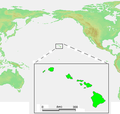
Fail:Hawaii Islands2.png
Hawaii_Islands2.png (287 × 273 piksel, saiz fail: 47 KB, jenis MIME: image/png)
Sejarah fail
Klik pada tarikh/waktu untuk melihat rupa fail tersebut pada waktu itu.
| Tarikh/Waktu | Gambar kenit | Ukuran | Pengguna | Komen | |
|---|---|---|---|---|---|
| semasa | 13:44, 5 Januari 2007 |  | 287 × 273 (47 KB) | Roke~commonswiki | smaller version of Image:Hawaii Islands.PNG to fit easier in country box on article Category:Maps of Hawaii {{PD-Demis}} |
Penggunaan fail
6 buah laman berikut menggunakan fail ini:
Penggunaan fail sejagat
Fail ini digunakan oleh wiki-wiki lain yang berikut:
- Penggunaan di af.wikipedia.org
- Penggunaan di am.wikipedia.org
- Penggunaan di ang.wikipedia.org
- Penggunaan di ar.wikipedia.org
- Penggunaan di bat-smg.wikipedia.org
- Penggunaan di ba.wikipedia.org
- Penggunaan di bg.wikipedia.org
- Penggunaan di bn.wikipedia.org
- Penggunaan di ca.wikipedia.org
- Penggunaan di ckb.wikipedia.org
- Penggunaan di cs.wikipedia.org
- Penggunaan di cv.wikipedia.org
- Penggunaan di da.wikipedia.org
- Penggunaan di de.wikipedia.org
- Penggunaan di en.wikipedia.org
- Penggunaan di eo.wiktionary.org
- Penggunaan di eu.wikipedia.org
- Penggunaan di fa.wikipedia.org
- Penggunaan di fi.wikipedia.org
- Penggunaan di fi.wikinews.org
- Penggunaan di fo.wikipedia.org
- Penggunaan di fr.wikipedia.org
- Penggunaan di fy.wikipedia.org
- Penggunaan di gd.wikipedia.org
- Penggunaan di gv.wikipedia.org
- Penggunaan di hak.wikipedia.org
- Penggunaan di he.wikipedia.org
- Penggunaan di hu.wikiquote.org
- Penggunaan di hy.wikipedia.org
Lihat banyak lagi penggunaan sejagat bagi fail ini.


