
Fail:NavassaIsland.jpeg
Saiz pralihat ini: 757 × 599 piksel. Leraian-leraian lain: 303 × 240 piksel | 606 × 480 piksel | 970 × 768 piksel | 1,280 × 1,013 piksel | 1,829 × 1,448 piksel.
Fail asli (1,829 × 1,448 piksel, saiz fail: 751 KB, jenis MIME: image/jpeg)


Ringkasan
| Keterangan |
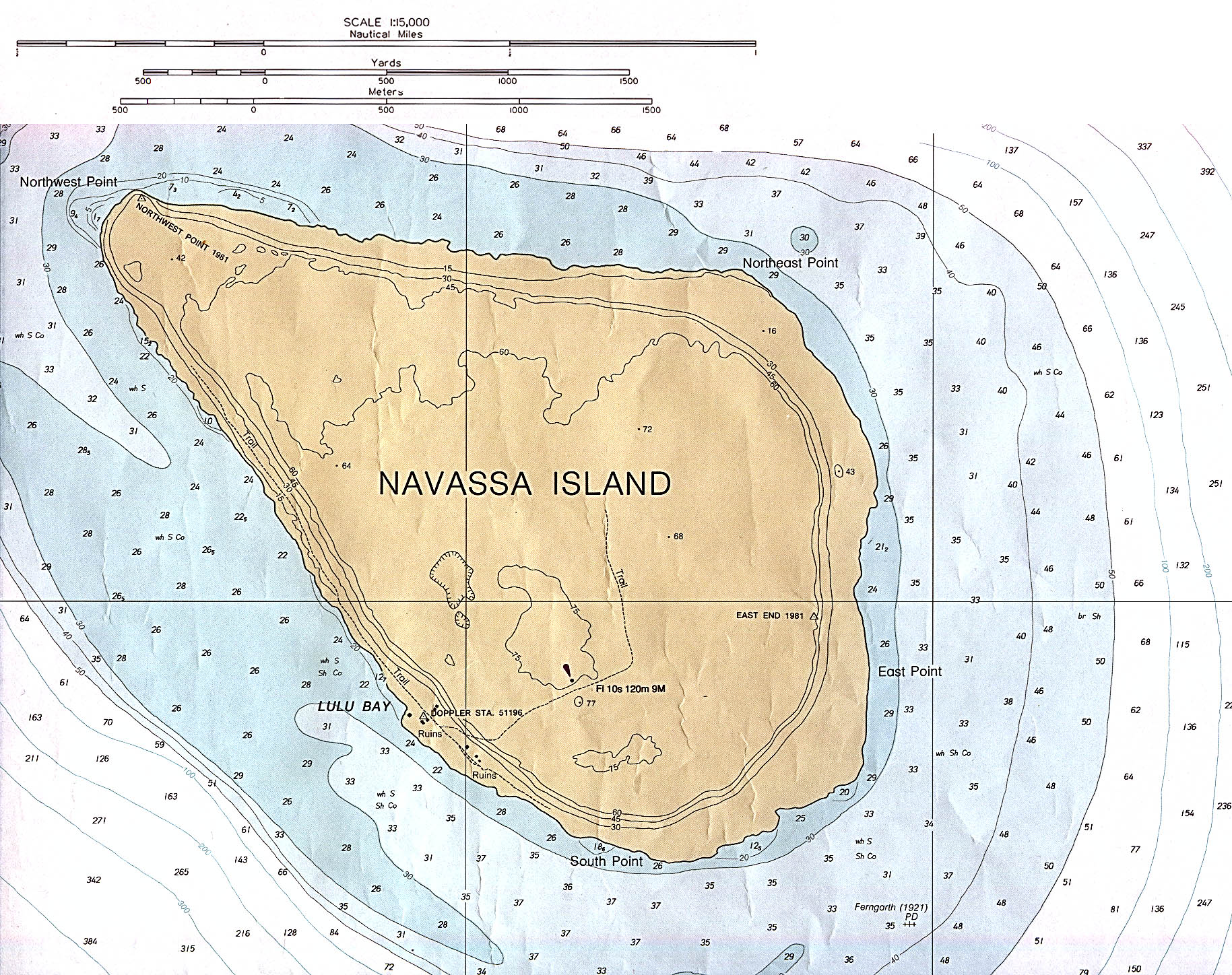
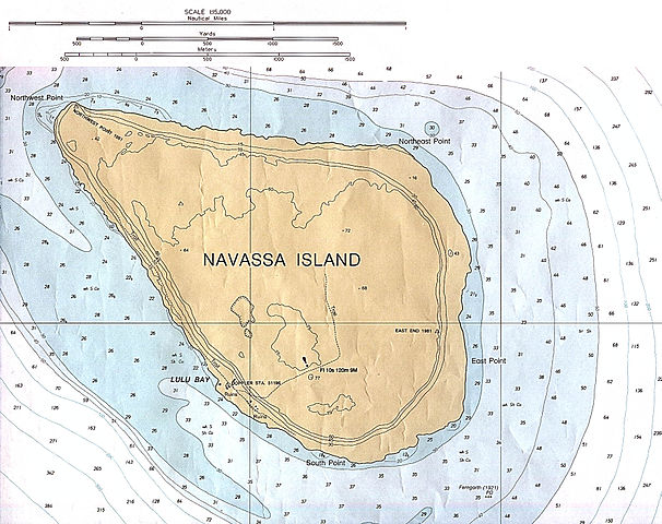
English: Navassa Island (Nautical Chart) original scale 1:15,000 Defense Mapping Agency 1982, revised 1991. |
| Tarikh | 1982, revised 1991 |
| Sumber | description source: http://www.lib.utexas.edu/maps/navassa_island.html |
| Pengarang | US Government - Defense Mapping Agency |
Perlesenan
This work is in the public domain in the United States because it is a work prepared by an officer or employee of the United States Government as part of that person’s official duties under the terms of Title 17, Chapter 1, Section 105 of the US Code.
Note: This only applies to original works of the Federal Government and not to the work of any individual U.S. state, territory, commonwealth, county, municipality, or any other subdivision. This template also does not apply to postage stamp designs published by the United States Postal Service since 1978. (See § 313.6(C)(1) of Compendium of U.S. Copyright Office Practices). It also does not apply to certain US coins; see The US Mint Terms of Use.
|
 | |
| Fail ini telah dikenal pasti sebagai bebas daripada sekatan-sekatan yang dikenali mengikut undang-undang hak cipta, termasuk semua hak berkaitan dan berjiran. | ||
Sejarah fail
Klik pada tarikh/waktu untuk melihat rupa fail tersebut pada waktu itu.
| Tarikh/Waktu | Gambar kenit | Ukuran | Pengguna | Komen | |
|---|---|---|---|---|---|
| semasa | 23:49, 9 November 2012 | | 1,829 × 1,448 (751 KB) | Rd232 | Higher resolution version of file, from original PCL source |
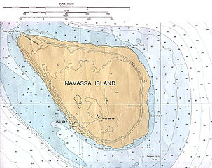
| 00:37, 16 Januari 2006 |  | 466 × 429 (16 KB) | *drew~commonswiki | *Description: Navassa Island *Source: En Wikipedia {{PD}} Category:Caribbean |
Penggunaan fail
Laman berikut menggunakan fail ini:
Penggunaan fail sejagat
Fail ini digunakan oleh wiki-wiki lain yang berikut:
- Penggunaan di cs.wikipedia.org
- Penggunaan di de.wikipedia.org
- Penggunaan di he.wikipedia.org
- Penggunaan di jv.wikipedia.org