
Fail:Niger - Location Map (2011) - NER - UNOCHA.svg

Fail asli (Fail SVG, ukuran dasar 254 × 254 piksel, saiz fail: 342 KB)
_-_NER_-_UNOCHA.svg)
Ringkasan
| Keterangan |
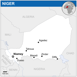
English: Locator map of Niger. |
| Tarikh | |
| Sumber |
English: Niger Locator Map (ReliefWeb) |
| Pengarang | |
| SVG genesis |
Perlesenan
- Anda bebas:
- untuk berkongsi – untuk menyalin, mengedar dan memindah hasil kerja
- untuk mencampur semula – untuk menyesuaikan karya
- Di bawah syarat berikut:
- pengiktirafan – Anda mesti memberi penghargaan yang berpatutan, bekalkan pautan ke lesen, dan tunjukkan jika perubahan telah dibuat. Anda boleh lakukannya dalam sebarang cara yang munasabah, tetapi bukan dalam sebarang cara yang mencadangkan pemberi lesen mengendors anda atau penggunaan anda.
 This map is part of a collection of 216 free country maps, created by the UN Office for the Coordination of Humanitarian Affairs (OCHA), to be used in print, web or broadcast products.
The ReliefWeb Location Maps released here are maps that highlight a country, its capital, major populated places and the surrounding regions. Attribution Requirements
Using the map without modifications: ensure that the sources and the disclaimer are below the map. Credit as follows: "Credit: OCHA". For use with alteration: remove the OCHA logo and disclaimer following any modification to the map, but keep the data sources as mentioned below the map. Credit the modified map as follows: "Based on OCHA map". You are responsible for the content of your map. We are keen to receive your feedback and hear how you used OCHA's maps. We would be grateful if you would notify us by e-mail and share your work with us. UN Disclaimer
The designations employed and the presentation of material of this map do not imply the expression of any opinion whatsoever on the part of the Secretariat of the United Nations concerning the legal status of any country, territory, city or area or of its authorities or concerning the delimitation of its frontiers or boundaries. |
Sejarah fail
Klik pada tarikh/waktu untuk melihat rupa fail tersebut pada waktu itu.
| Tarikh/Waktu | Gambar kenit | Ukuran | Pengguna | Komen | |
|---|---|---|---|---|---|
| semasa | 03:33, 18 November 2014 | | 254 × 254 (342 KB) | Pharos | try without logo for now |
| 00:05, 8 Mei 2014 |  | 254 × 254 (338 KB) | UN OCHA maps bot | == {{int:filedesc}} == {{Information |description={{en|1=Locator map of Niger.}} |date=2011 |source={{en|1=[http://reliefweb.int/map/niger/niger-location-map-2011 Niger Locator Map (ReliefWeb)]}} |author={{en|1=[[w:en:United Nations Offi... |
Penggunaan fail
Laman berikut menggunakan fail ini:
Penggunaan fail sejagat
Fail ini digunakan oleh wiki-wiki lain yang berikut:
- Penggunaan di azb.wikipedia.org
- Penggunaan di bh.wikipedia.org
- Penggunaan di bn.wikipedia.org
- Penggunaan di es.wikipedia.org
- Penggunaan di hu.wikipedia.org
- Penggunaan di id.wikipedia.org
- Penggunaan di ilo.wikipedia.org
- Penggunaan di lb.wikipedia.org
- Penggunaan di ne.wikipedia.org
- Penggunaan di pl.wikipedia.org
- Penggunaan di sco.wikipedia.org
- Penggunaan di sd.wikipedia.org
- Penggunaan di te.wikipedia.org
_-_NER_-_UNOCHA.svg)