Fail:Penang Malaysia Nagore-Durgha-Sheriff-01.jpg

Kandungan laman tidak disokong dalam bahasa lain.
Daripada Wikipedia, ensiklopedia bebas.

Fail asli(4,385 × 3,132 piksel, saiz fail: 7.56 MB, jenis MIME: image/jpeg)

Fail ini dari Wikimedia Commons dan mungkin digunakan oleh projek lain. Penerangan pada laman penerangan failnya di sana ditunjukkan di bawah.

Ringkasan

Keterangan
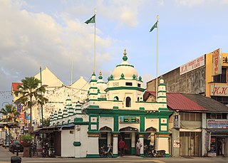
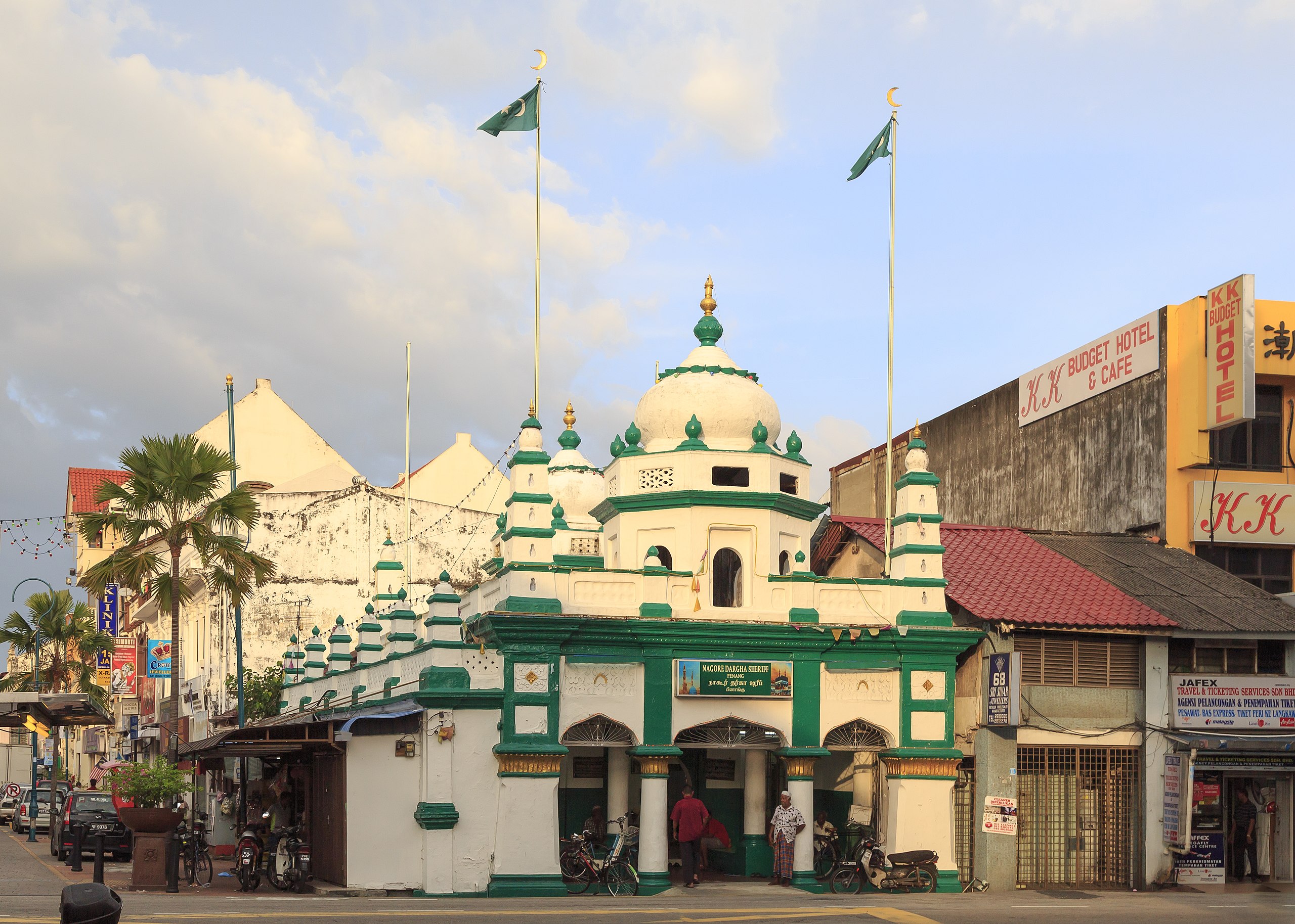
English: Penang, Malaysia: Nagore Durgha Sheriff (locally also Nagore Dargha Sheriff) or Nagore Shrine is a shrine to a Muslim saint located along Lebuh Chulia, at the junction with Lebuh King in the Little India of George Town, Penang.
Tarikh
Sumber Karya sendiri
Pengarang CEphoto, Uwe Aranas
Kebenaran
(Penggunaan semula fail ini)

This photo was created by Uwe Aranas. It is protected by law and is not in the Public Domain. However, it can be used free of charge by everyone under the terms of the license stated below.

  • The requirements to comply with the terms of licence are:
- The image is credited with "Photo by CEphoto, Uwe Aranas" or alternatively with "© CEphoto, Uwe Aranas" in close relation to the image. If this is not possible due to shortage of space, please contact me first.
- You are required to release the image under the same license.
  • Not required by the license but highly appreciated:
- Set up a weblink to the original image when you use the image in online media: https://commons.wikimedia.org/wiki/File:Penang_Malaysia_Nagore-Durgha-Sheriff-01.jpg
- Send me a specimen copy or a pdf when used in print media or the URL of the website where the image is used.

Please write an email to spam@aranas.de (where you substitute the word spam by cephoto2020), if you

  • need the image in a higher resolution
  • need my postal address for sending a specimen copy
  • have further questions to the terms of licence

This file has been released under a license which is incompatible with Facebook Inc.'s licensing terms . It is not permitted to upload this file to their social media platforms such as Facebook or Instagram.

Pengiktirafan
(required by the license)
InfoField
Photo by CEphoto, Uwe Aranas / 
Photo by CEphoto, Uwe Aranas
Lokasi objek5° 24′ 58.72″ U, 100° 20′ 19.8″ T Kartographer map based on OpenStreetMap.Paparkan imej ini dan imej berdekatan yang lain di: OpenStreetMapinfo

Do not upload new revisions over this file version without my explicit consent. Instead, use the possibility to upload a new version under a new name and tag it as a derivate or extract of this file.

Imej berkualiti
Imej ini telah dinilai berdasarkan garis panduan imej berkualiti dan ia dianggap sebagai imej berkualiti.

العربية  جازايرية  беларуская  беларуская (тарашкевіца)  български  বাংলা  català  čeština  Cymraeg  Deutsch  Schweizer Hochdeutsch  Zazaki  Ελληνικά  English  Esperanto  español  eesti  euskara  فارسی  suomi  français  galego  עברית  हिन्दी  hrvatski  magyar  հայերեն  Bahasa Indonesia  italiano  日本語  Jawa  ქართული  한국어  kurdî  Lëtzebuergesch  lietuvių  македонски  മലയാളം  मराठी  Bahasa Melayu  Nederlands  Norfuk / Pitkern  polski  português  português do Brasil  rumantsch  română  русский  sicilianu  slovenčina  slovenščina  shqip  српски / srpski  svenska  தமிழ்  తెలుగు  ไทย  Tagalog  Türkçe  toki pona  українська  vèneto  Tiếng Việt  中文  中文(简体)  中文(繁體)  +/−

Perlesenan

Dengan ini, saya selaku pemegang hak cipta karya ini, menerbitkannya di bawah lesen yang berikut:
w:ms:Creative Commons
pengiktirafan perkongsian serupa
Pengiktirafan: Photo by CEphoto, Uwe Aranas or alternatively © CEphoto, Uwe Aranas
Anda bebas:
  • untuk berkongsi – untuk menyalin, mengedar dan memindah hasil kerja
  • untuk mencampur semula – untuk menyesuaikan karya
Di bawah syarat berikut:
  • pengiktirafan – Anda mesti memberi penghargaan yang berpatutan, bekalkan pautan ke lesen, dan tunjukkan jika perubahan telah dibuat. Anda boleh lakukannya dalam sebarang cara yang munasabah, tetapi bukan dalam sebarang cara yang mencadangkan pemberi lesen mengendors anda atau penggunaan anda.
  • perkongsian serupa – Jika anda mengubah, adun semula, atau menokok tambah bahan, anda mesti menyebarkan sumbangan anda di bawah lesen yang sama atau serasi dengan yang asal.

Captions

Add a one-line explanation of what this file represents

Items portrayed in this file

menggambarkan

7 Januari 2014

5°24'58.716"N, 100°20'19.795"E

0.00625 saat

ISO speed Inggeris

100

MIME type Inggeris

image/jpeg

Sejarah fail

Klik pada tarikh/waktu untuk melihat rupa fail tersebut pada waktu itu.

Tarikh/WaktuGambar kenitUkuranPenggunaKomen
semasa19:06, 2 April 2015Gambar kenit bagi versi pada 19:06, 2 April 20154,385 × 3,132 (7.56 MB)Cccefalon=={{int:filedesc}}== {{Information |description={{en|1=Penang, Malaysia: '''Nagore Durgha Sheriff''' (locally also ''Nagore Dargha Sheriff'') or '''Nagore Shrine''' is a shrine to a Muslim saint located along Lebuh Chulia, at the junction with Lebuh K...

Laman berikut menggunakan fail ini:

Penggunaan fail sejagat

Fail ini digunakan oleh wiki-wiki lain yang berikut:

Metadata