
Fail:Srinagar city 1959.jpg

Saiz pralihat ini: 470 × 599 piksel. Leraian-leraian lain: 188 × 240 piksel | 377 × 480 piksel | 909 × 1,158 piksel.
Fail asli (909 × 1,158 piksel, saiz fail: 142 KB, jenis MIME: image/jpeg)
Ringkasan
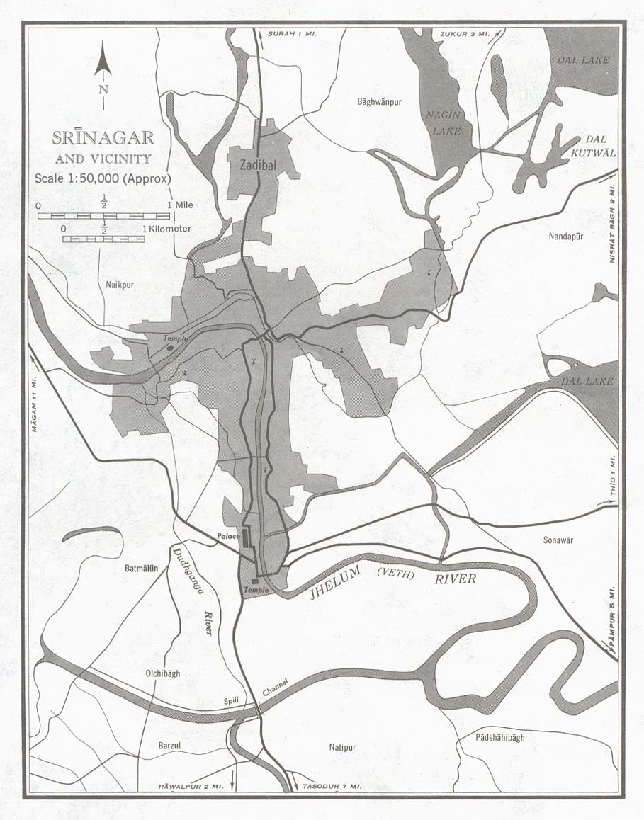
| Keterangan | Srinagar, India: city and its vicinity in 1959. Original description at http://www.lib.utexas.edu/maps/kashmir.html: "Portion of sheet NI 43-6 Srinagar. Edition May 1959. Original scale 1:50,000 Compiled in 1954 from Survey of India. Published by the U.S. Army Map Service, July 1959 (146K) Not for navigational use." |
| Tarikh | |
| Sumber | |
| Pengarang | U.S. Army Map Service |
Perlesenan
This work is in the public domain in the United States because it is a work prepared by an officer or employee of the United States Government as part of that person’s official duties under the terms of Title 17, Chapter 1, Section 105 of the US Code.
Note: This only applies to original works of the Federal Government and not to the work of any individual U.S. state, territory, commonwealth, county, municipality, or any other subdivision. This template also does not apply to postage stamp designs published by the United States Postal Service since 1978. (See § 313.6(C)(1) of Compendium of U.S. Copyright Office Practices). It also does not apply to certain US coins; see The US Mint Terms of Use.
|
 | |
| Fail ini telah dikenal pasti sebagai bebas daripada sekatan-sekatan yang dikenali mengikut undang-undang hak cipta, termasuk semua hak berkaitan dan berjiran. | ||
Sejarah fail
Klik pada tarikh/waktu untuk melihat rupa fail tersebut pada waktu itu.
| Tarikh/Waktu | Gambar kenit | Ukuran | Pengguna | Komen | |
|---|---|---|---|---|---|
| semasa | 14:52, 15 November 2005 | | 909 × 1,158 (142 KB) | Vyzasatya | Srinagar,India city and its vicinity in 1959. This map is taken from http://www.lib.utexas.edu/maps/historical/srinagar_city_1959.jpg |
Penggunaan fail
Laman berikut menggunakan fail ini:
Penggunaan fail sejagat
Fail ini digunakan oleh wiki-wiki lain yang berikut:
- Penggunaan di en.wikipedia.org
- Penggunaan di ru.wikipedia.org
- Penggunaan di te.wikipedia.org