
Fail:Propaganda Map.jpg

Saiz pralihat ini: 800 × 349 piksel. Leraian-leraian lain: 320 × 139 piksel | 640 × 279 piksel | 1,024 × 446 piksel | 1,280 × 558 piksel | 2,560 × 1,115 piksel | 17,175 × 7,482 piksel.
Fail asli (17,175 × 7,482 piksel, saiz fail: 22.1 MB, jenis MIME: image/jpeg)
Ringkasan
| Warning | The original file is very high-resolution. It might not load properly or could cause your browser to freeze when opened at full size. |
|---|
| Seniman |
Diogo Ribeiro (d. 1533) William Griggs (1832–1911) |
||||||||||||||||||||||||||
| Pengarang |
Unknown author |
||||||||||||||||||||||||||
| Tajuk |
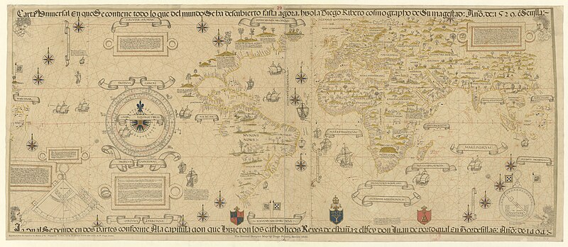
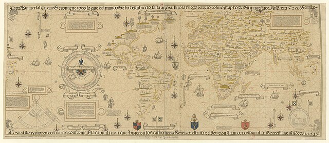
Propaganda Map 1529 Ribeiro Planisphere Second Borgian Map Carta Universal Carta Universal en que Se Contiene Todo lo que del Mundo Se Ha Descubierto Fasta Agora, Hizola Diego Ribero Cosmographo de Su Magestad, Año de 1529, e[n] Sevilla La Cual Se Devide en Dos Partes Conforme a la Capitulacion que Hizieron los Catholicos Reyes de España y el Rrey Don Juan de Portogual en Tordesillas Año de 1494. |
||||||||||||||||||||||||||
| Keterangan |
English: c. 1887 reproduction on two sheets of the 1529 Propaganda world map, believed to be a reproduction by Diogo Ribeiro of the Spanish Padron Real (Royal Standard Map) held at the Seville Casa de Contratacion (House of Trade). It shows Spanish uncertainty regarding the Pacific Coast of the Americas, the Spice Islands, and the exact details of locations around the Indian Ocean, while adding additional information from the expeditions of Magellan and others.
Français : Sujet : Monde -- Mappemondes -- 1529
Couverture : Monde Langue : italien Éditeur : [s.n.] (London) |
||||||||||||||||||||||||||
| Depicted place |
World Spanish Empire |
||||||||||||||||||||||||||
| Tarikh | 1529 | ||||||||||||||||||||||||||
| Matra |
tinggi: 61 cm; lebar: 79 cm tinggi: 61 cm; lebar: 66 cm |
||||||||||||||||||||||||||
| Koleksi |
|
||||||||||||||||||||||||||
| Rujukan |
Français : Notice du catalogue : http://catalogue.bnf.fr/ark:/12148/cb407745741 |
||||||||||||||||||||||||||
| Sumber/Jurugambar |
Français : Bibliothèque nationale de France, département Cartes et plans, GE C-818
Bibliothèque nationale de France |
||||||||||||||||||||||||||
| Kebenaran (Penggunaan semula fail ini) |
|
||||||||||||||||||||||||||
| Versi lain |
|
||||||||||||||||||||||||||


Sejarah fail
Klik pada tarikh/waktu untuk melihat rupa fail tersebut pada waktu itu.
| Tarikh/Waktu | Gambar kenit | Ukuran | Pengguna | Komen | |
|---|---|---|---|---|---|
| semasa | 17:39, 19 Ogos 2022 | | 17,175 × 7,482 (22.1 MB) | Gzen92Bot | Gallica btv1b53023022k |
Penggunaan fail
Laman berikut menggunakan fail ini:
Penggunaan fail sejagat
Fail ini digunakan oleh wiki-wiki lain yang berikut:
- Penggunaan di ar.wikipedia.org
- Penggunaan di ast.wikipedia.org
- Penggunaan di bn.wikipedia.org
- Penggunaan di ca.wikipedia.org
- Penggunaan di de.wikipedia.org
- Penggunaan di el.wikipedia.org
- Penggunaan di en.wikipedia.org
- Penggunaan di eo.wikipedia.org
- Penggunaan di es.wikipedia.org
- Penggunaan di eu.wikipedia.org
- Penggunaan di fa.wikipedia.org
- Penggunaan di fi.wikipedia.org
- Penggunaan di fr.wikipedia.org
- Penggunaan di gl.wikipedia.org
- Penggunaan di it.wikipedia.org
Lihat banyak lagi penggunaan sejagat bagi fail ini.