
Fail:Aerial view of the U.S. Naval Air Station Cubi Point, Philippines, on 6 February 1988 (6482943).jpg
Saiz pralihat ini: 799 × 600 piksel. Leraian-leraian lain: 320 × 240 piksel | 640 × 480 piksel | 1,023 × 768 piksel | 1,280 × 961 piksel | 2,560 × 1,922 piksel | 3,000 × 2,252 piksel.
Fail asli (3,000 × 2,252 piksel, saiz fail: 2.2 MB, jenis MIME: image/jpeg)
.jpg)
Ringkasan
| Keterangan |
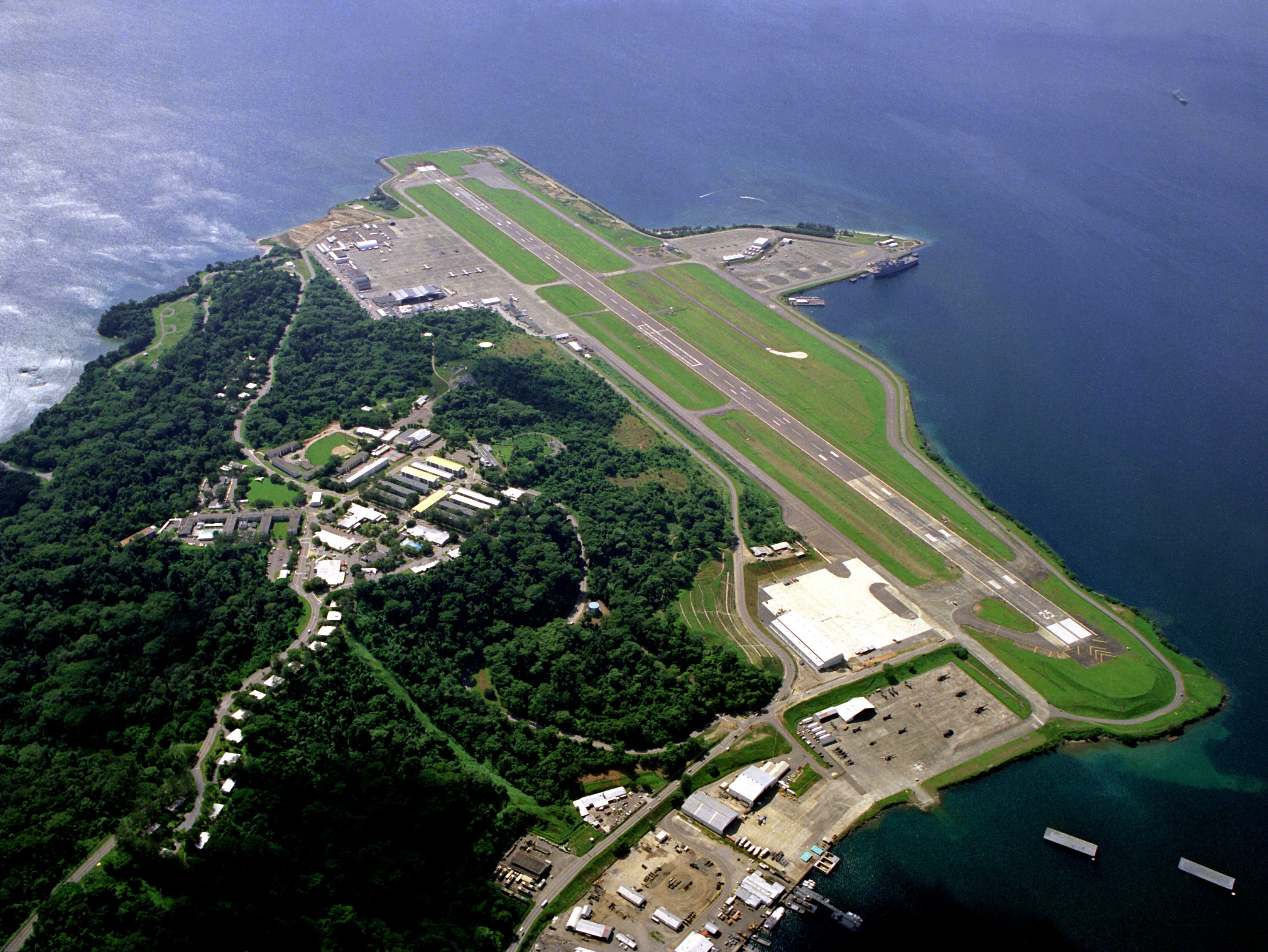
English: An aerial view of the runway and flight line of the U.S. Naval Air Station Cubi Point, Philippines, on 6 February 1988. |
|||
| Tarikh | ||||
| Sumber |
|
|||
| Pengarang | PH2(NAC) David Sanner, U.S. Navy |
| Lokasi kamera | | Paparkan imej ini dan imej berdekatan yang lain di: OpenStreetMap |
|---|
.jpg¶ms=014.794880_N_0120.272230_E_globe:Earth_type:camera__&language=ms)
Perlesenan
This file is a work of a sailor or employee of the U.S. Navy, taken or made as part of that person's official duties. As a work of the U.S. federal government, it is in the public domain in the United States.
|
 | |
| Fail ini telah dikenal pasti sebagai bebas daripada sekatan-sekatan yang dikenali mengikut undang-undang hak cipta, termasuk semua hak berkaitan dan berjiran. | ||
Log muat naik asal
The original description page was here. All following user names refer to en.wikipedia.
- 2006-08-25 12:43 SunKing 3000×2252× (2304748 bytes) ID: DNSC9300780 Service Depicted: Navy An aerial view of the runway and flight line. Location: NAVAL AIR STATION, CUBI POINT, LUZON PHILIPPINES (PHL) Camera Operator: PH2(NAC) DAVID SANNER Date Shot: 6 Feb 1988 {{PD-USGov-Military-Navy}}
Sejarah fail
Klik pada tarikh/waktu untuk melihat rupa fail tersebut pada waktu itu.
| Tarikh/Waktu | Gambar kenit | Ukuran | Pengguna | Komen | |
|---|---|---|---|---|---|
| semasa | 11:50, 5 Jun 2011 | | 3,000 × 2,252 (2.2 MB) | File Upload Bot (Magnus Manske) | {{BotMoveToCommons|en.wikipedia|year={{subst:CURRENTYEAR}}|month={{subst:CURRENTMONTHNAME}}|day={{subst:CURRENTDAY}}}} {{Information |Description={{en|ID: DNSC9300780 Service Depicted: Navy An aerial view of the runway and flight line. Location: NAVA |
Penggunaan fail
Laman berikut menggunakan fail ini:
Penggunaan fail sejagat
Fail ini digunakan oleh wiki-wiki lain yang berikut:
- Penggunaan di ceb.wikipedia.org
- Penggunaan di en.wikipedia.org
- Penggunaan di es.wikipedia.org
- Penggunaan di eu.wikipedia.org
- Penggunaan di fa.wikipedia.org
- Penggunaan di fr.wikipedia.org
- Penggunaan di hu.wikipedia.org
- Penggunaan di id.wikipedia.org
- Penggunaan di it.wikipedia.org
- Penggunaan di ja.wikipedia.org
- Penggunaan di nl.wikipedia.org
- Penggunaan di pl.wikipedia.org
- Penggunaan di sv.wikipedia.org
- Penggunaan di th.wikipedia.org
- Penggunaan di tl.wikipedia.org
- Penggunaan di vi.wikipedia.org
- Penggunaan di www.wikidata.org
.jpg)