
Fail:LocationRomanEmpire.png
Saiz pralihat ini: 800 × 520 piksel. Leraian-leraian lain: 320 × 208 piksel | 640 × 416 piksel | 1,084 × 705 piksel.
Fail asli (1,084 × 705 piksel, saiz fail: 34 KB, jenis MIME: image/png)

|
File:Map of the Roman Empire at its height.svg merupakan versi vektor bagi fail ini. Ia sepatutnya digunakan bagi menggantikan imej raster ini apabila ia mempunyai peleraian yang lebih besar dan lebih baik.
File:LocationRomanEmpire.png → File:Map of the Roman Empire at its height.svg
Untuk maklumat lanjut, sila lihat Bantuan:SVG. Anda juga boleh melihat maklumat mengenai sokongan imej SVG MediaWiki. |
 |
| Keterangan |
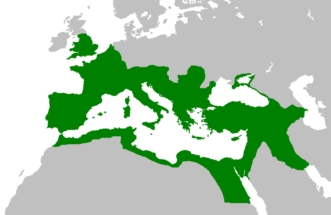
English: Map of the Roman Empire at its height, under Trajan.
Esperanto: Mapo de la Roma Imperio je ĝia plej vasta etendo, sub la imperiestro Trajano.
Español: El Imperio Romano a su máxima extensión, durante el reinado de Trajano.
Suomi: Rooman valtakunta Trajanuksen aikana.
Français : L'Empire romain à son apogée, sous Trajan.
Italiano: Mappa dell'Impero Romano al culmine della sua estensione, sotto Traiano.
日本語: 117年(トラヤヌス帝の時代)のローマ帝国の最大領土
Português: Localização do Império Romano em sua extensão máxima. |
||||||||
| Tarikh | |||||||||
| Sumber | Previous version | ||||||||
| Pengarang | User:Jrockley / User:Kasper Holl | ||||||||
| Kebenaran (Penggunaan semula fail ini) |
|
||||||||
| Versi lain |
|

Sejarah fail
Klik pada tarikh/waktu untuk melihat rupa fail tersebut pada waktu itu.
| Tarikh/Waktu | Gambar kenit | Ukuran | Pengguna | Komen | |
|---|---|---|---|---|---|
| semasa | 14:44, 2 Jun 2007 | | 1,084 × 705 (34 KB) | Medievalista | Ok, sorry, my mistake... here is the new map |
| 14:42, 2 Jun 2007 |  | 1,084 × 705 (34 KB) | Medievalista | Update of the previous map: less of teritory in Africa, withdraw in Britain up to the future Hadrianic wall and improve the trace of the Rhine-Danube frontier | |
| 03:45, 5 Februari 2007 |  | 1,084 × 705 (35 KB) | Jrockley | lil bit more Africa, lil less Scandinavia | |
| 03:28, 5 Februari 2007 |  | 1,259 × 756 (41 KB) | Jrockley | Much larger version, as faithful as possible | |
| 12:24, 9 Ogos 2005 |  | 250 × 175 (8 KB) | Kasper Holl | Map of the location of the Roman Empire at its height, under Trajan. Made from the Blank Map World. |
Penggunaan fail
Tiada laman yang menggunakan fail ini.
Penggunaan fail sejagat
Fail ini digunakan oleh wiki-wiki lain yang berikut:
- Penggunaan di en.wikipedia.org
- Penggunaan di he.wikipedia.org
- Penggunaan di hy.wikipedia.org
- Penggunaan di it.wikipedia.org
- Penggunaan di kk.wikipedia.org