
Fail:Locator map of the Union of South Africa.svg

Size of this PNG preview of this SVG file: 800 × 400 piksel. Leraian-leraian lain: 320 × 160 piksel | 640 × 320 piksel | 1,024 × 512 piksel | 1,280 × 640 piksel | 2,560 × 1,280 piksel | 1,000 × 500 piksel.
Fail asli (Fail SVG, ukuran dasar 1,000 × 500 piksel, saiz fail: 2.76 MB)
Ringkasan
| Keterangan |
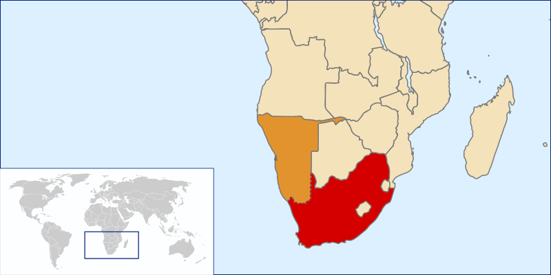
English: Location of the Union of South Africa, 1915-1961 |
| Sumber | Own work by uploader based on File:LocationSouthAfrica.svg |
| Pengarang | Seb az86556 |
Perlesenan
Dengan ini, saya selaku pemegang hak cipta karya ini, menerbitkannya di bawah lesen yang berikut:
Fail ini dilesenkan di bawah lesen Pengiktirafan 3.0 Tidak Diport Creative Commons.
- Anda bebas:
- untuk berkongsi – untuk menyalin, mengedar dan memindah hasil kerja
- untuk mencampur semula – untuk menyesuaikan karya
- Di bawah syarat berikut:
- pengiktirafan – Anda mesti memberi penghargaan yang berpatutan, bekalkan pautan ke lesen, dan tunjukkan jika perubahan telah dibuat. Anda boleh lakukannya dalam sebarang cara yang munasabah, tetapi bukan dalam sebarang cara yang mencadangkan pemberi lesen mengendors anda atau penggunaan anda.
Sejarah fail
Klik pada tarikh/waktu untuk melihat rupa fail tersebut pada waktu itu.
| Tarikh/Waktu | Gambar kenit | Ukuran | Pengguna | Komen | |
|---|---|---|---|---|---|
| semasa | 21:38, 19 Jun 2010 | | 1,000 × 500 (2.76 MB) | Seb az86556 | show SWA as contested area |
| 19:34, 27 Julai 2009 |  | 1,000 × 500 (2.76 MB) | Seb az86556 | {{Information |Description={{en|1=Location of the Union of South Africa, 1910-1961}} |Source=Own work by uploader based on File:LocationSouthAfrica.svg |Author=Seb az86556 |Date= |Permission= |other_versions= }} [[Category:Maps |
Penggunaan fail
Tiada laman yang menggunakan fail ini.
Penggunaan fail sejagat
Fail ini digunakan oleh wiki-wiki lain yang berikut:
- Penggunaan di en.wikipedia.org
- Penggunaan di he.wikipedia.org
- Penggunaan di hy.wikipedia.org
- Penggunaan di zh.wikipedia.org