
Fail:OttomanEmpire1801.jpg
Fail asli (1,638 × 1,296 piksel, saiz fail: 605 KB, jenis MIME: image/jpeg)

Ringkasan
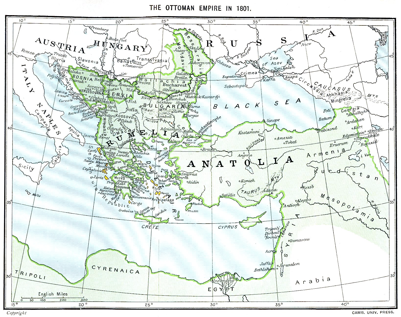
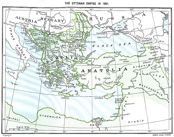
Ottoman Empire (green) and Septinsular Republic (yellow) in 1801.
Perlesenan
|
Karya ini berada dalam domain awam di negara-negara dengan tempoh hak cipta hayat pencipta ditambah 70 tahun atau kurang.
| |
| Fail ini telah dikenal pasti sebagai bebas daripada sekatan-sekatan yang dikenali mengikut undang-undang hak cipta, termasuk semua hak berkaitan dan berjiran. | |
Sejarah fail
Klik pada tarikh/waktu untuk melihat rupa fail tersebut pada waktu itu.
| Tarikh/Waktu | Gambar kenit | Ukuran | Pengguna | Komen | |
|---|---|---|---|---|---|
| semasa | 16:06, 11 Januari 2023 | | 1,638 × 1,296 (605 KB) | Enyavar | Reverted to version as of 08:56, 11 March 2006 (UTC) --> even if they are wrong, don't change historical maps! |
| 17:48, 3 Februari 2014 |  | 1,638 × 1,296 (518 KB) | Spiridon Ion Cepleanu | Some little changes according with the 1801 situation : The Septinsular Rep. includes Ionian Is., not the Cyclades, Serbia became autonomous 1817... | |
| 08:56, 11 Mac 2006 |  | 1,638 × 1,296 (605 KB) | Julo | Ottoman Empire (green) & Septinsular Republic (yellow) in 1801, on the 19th century map {{PD-old}} category:19th century mapsCategory:Historical maps of the Middle EastCategory:Historical maps of the Balkans[[Category:Historical maps of Africa |
Penggunaan fail
Tiada laman yang menggunakan fail ini.
Penggunaan fail sejagat
Fail ini digunakan oleh wiki-wiki lain yang berikut:
- Penggunaan di azb.wikipedia.org
- Penggunaan di ba.wikipedia.org
- Penggunaan di el.wikipedia.org
- Penggunaan di fr.wikipedia.org
- Penggunaan di hy.wikipedia.org
- Penggunaan di la.wikipedia.org
- Penggunaan di pl.wikipedia.org
- Penggunaan di sq.wikipedia.org
- Penggunaan di sv.wikipedia.org
- Penggunaan di uk.wikipedia.org