
Fail:SeychellesBIOT1970.jpg
Tiada leraian lebih besar.
SeychellesBIOT1970.jpg (780 × 283 piksel, saiz fail: 72 KB, jenis MIME: image/jpeg)
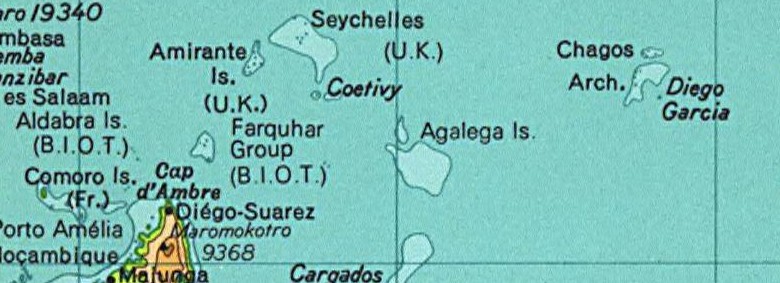
Map of the Seychelles and British Indian Ocean Territory prior to 1976. From the National Atlas as mirrored by the PCL.
This map was obtained from an edition of the National Atlas of the United States. Like almost all works of the U.S. federal government, works from the National Atlas are in the public domain in the United States.
Online access: NationalAtlas.gov | 1970 print edition: Library of Congress, Perry-Castañeda Library
|
This map was cropped from there.
Sejarah fail
Klik pada tarikh/waktu untuk melihat rupa fail tersebut pada waktu itu.
| Tarikh/Waktu | Gambar kenit | Ukuran | Pengguna | Komen | |
|---|---|---|---|---|---|
| semasa | 02:01, 13 Ogos 2005 | 780 × 283 (72 KB) | Hoshie | Map of the Seychelles and British Indian Ocean Territory piror to 1976. From the National Atlas as mirrored by the [http://www.lib.utexas.edu/maps/ PCL]. {{PD-USGov-Atlas}} {{PD-PCL|http://www.lib.utexas.edu/maps/national_atlas_1970/ca000244_large.jpg}} |
Penggunaan fail
Tiada laman yang menggunakan fail ini.
Penggunaan fail sejagat
Fail ini digunakan oleh wiki-wiki lain yang berikut:
- Penggunaan di af.wikipedia.org
- Penggunaan di ast.wikipedia.org
- Penggunaan di ca.wikipedia.org
- Penggunaan di el.wikipedia.org
- Penggunaan di en.wikipedia.org
- Penggunaan di eo.wikipedia.org
- Penggunaan di id.wikipedia.org
- Penggunaan di tl.wikipedia.org
- Penggunaan di zh.wikipedia.org