
Fail:Three Gorges Dam, China.jpg

Fail asli (3,072 × 2,039 piksel, saiz fail: 1.42 MB, jenis MIME: image/jpeg)
Ringkasan
| Keterangan |
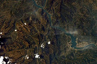
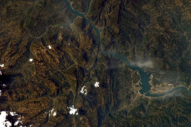
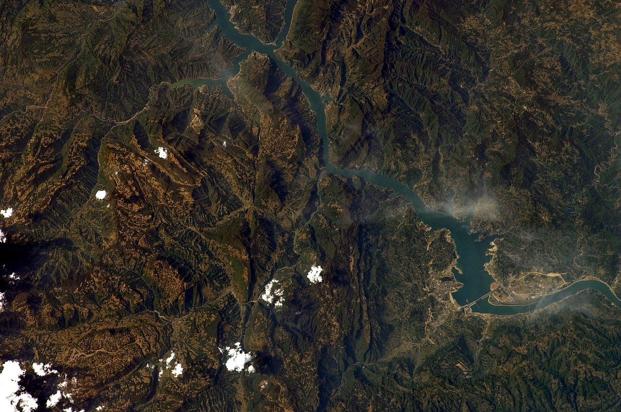
English: This image captures the flooding behind the Three Gorges Dam (north is up).
This photograph was acquired with a Nikon 2DXs digital camera fitted with a 180 mm lens, and is provided by the ISS Crew Earth Observations experiment and Image Science & Analysis Laboratory, Johnson Space Centre. Instrument: ISS - Digital Camera
|
||||||||||||||||||||||||||||||||||||||||||||||||||||||
| Tarikh | |||||||||||||||||||||||||||||||||||||||||||||||||||||||
| Sumber | NASA Earth Observatory | ||||||||||||||||||||||||||||||||||||||||||||||||||||||
| Pengarang | This image was taken by the NASA Expedition 19 crew. | ||||||||||||||||||||||||||||||||||||||||||||||||||||||
| Versi lain | File:Three Gorges Dam on the Yangtze River.jpg | ||||||||||||||||||||||||||||||||||||||||||||||||||||||
| Lokasi kamera | | Paparkan imej ini dan imej berdekatan yang lain di: OpenStreetMap |
|---|
This image or video was catalogued by Johnson Space Center of the United States National Aeronautics and Space Administration (NASA) under Photo ID: ISS019-E-7720. This tag does not indicate the copyright status of the attached work. A normal copyright tag is still required. See Commons:Licensing. Other languages:
|
Perlesenan
| This file is in the public domain in the United States because it was solely created by NASA. NASA copyright policy states that "NASA material is not protected by copyright unless noted". (See Template:PD-USGov, NASA copyright policy page or JPL Image Use Policy.) | ||
 |
Warnings:
|
Sejarah fail
Klik pada tarikh/waktu untuk melihat rupa fail tersebut pada waktu itu.
| Tarikh/Waktu | Gambar kenit | Ukuran | Pengguna | Komen | |
|---|---|---|---|---|---|
| semasa | 09:08, 30 September 2010 | | 3,072 × 2,039 (1.42 MB) | Originalwana | rotated |
| 09:19, 5 Jun 2010 |  | 3,072 × 2,039 (3.36 MB) | Originalwana | higher res | |
| 09:42, 8 Jun 2009 |  | 1,440 × 1,080 (636 KB) | Originalwana | {{Information |Description={{en|1=This image captures the flooding behind the Three Gorges Dam.}} |Source=http://earthobservatory.nasa.gov/IOTD/view.php?id=38879&src=iotdrss |Author=This image was taken by the NASA Expedition 19 crew. |Date=2009-04-15 |Pe |
Penggunaan fail
Laman berikut menggunakan fail ini:
Penggunaan fail sejagat
Fail ini digunakan oleh wiki-wiki lain yang berikut:
- Penggunaan di bo.wikipedia.org
- Penggunaan di kbp.wikipedia.org
- Penggunaan di pl.wikipedia.org
- Penggunaan di pnb.wikipedia.org